- +40-700-123-4567
- email@example.com
- 14th Street, New York


Where is Amran Governorate located?
Amran governorate lies to the north of the capital, Sana'a, about 50 km from it. The governorate is linked to Sa’ada governorate from the north, Sana'a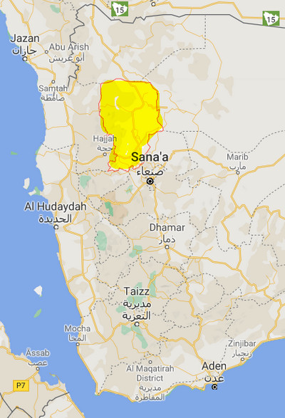 governorate from the south, Hajjah and Mahwit governorates from the west, and Al-Jawf and Sana'a to the east. Harf Sufyan district is the largest in the governorate, with an area of (2782) km2, while Amran district is the smallest in terms of area (120) km2.
What is the area of Amran Governorate?
The area of the governorate is about (7971) km2, distributed over (20) districts.
What is the estimated population in Amran Governorate?
According to the results of the 2004 Census of Population, Housing and Establishments, its population reached (877,786), with an annual increase rate of (1.82%).
What are the districts of Amran governorate?
Amran governorate is divided into (20) districts according to the last administrative division as follows:
- Al Ashah District
- Al Madan District
- Al Qaflah District
- Amran District
- As Sawd District
- As Sudah District
- Bani Suraim District
- Dhi Bin District
- Habur Zulaymah District
- Harf Sufyan District
- Huth District
- Iyal Surayh District
- Jabal Iyal Yazid District
- Khamir District
- Kharif District
- Maswar District
- Raydah District
- Shaharah District
- Suwayr District
- Thula District
What are the main tourist and historical landmarks in Amran Governorate?
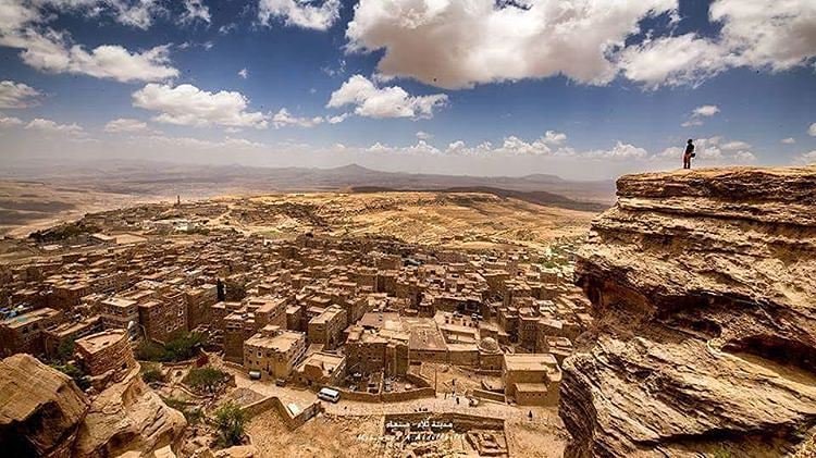
Amran is one of the governorates that stores archaeological wealth, Islamic monuments, ancient cities, castles and historical forts, and steep peaks and mountains, such as:
The old market of Amran, the old city of Amran surrounded by the mud wall, the city of Dina, the historic city of Habab a, the fortress of Dhofar Thibeen, the historic city of Thula, the fortress of Na’a, the city of Houth, the city of Khamer, and the old stone wall, and Maswar tourist mountains.
What is the climate of Amran Governorate?
The factors affecting the governorate's climate are altitude and surface level. Due to the diversity of the topography of Amran Governorate, its climate is characterized by diversity. In the northern parts of the governorate, the climate is mostly temperate, with the exception of some highlands, where the weather becomes cooler, especially in winter. As for the western parts of the governorate with high altitude, a cold climate prevails in winter and moderate in summer.
Sources:
- Central Statistical Organization, 2006
- Wikipedia - National Information Center (Arabic)
- HUMAN ACCESS (Media Center)
- Yemen figures and facts (the National Information Center).
- Results of the tourism survey during the period from (1996-1999)
