- +40-700-123-4567
- email@example.com
- 14th Street, New York


Where is Al Mahwit governorate located?
Al Mahwit Governorate lies northwest of the capital, Sana'a, at a distance of (111 km). The governorate is 2100 meters above sea level. It is bordered by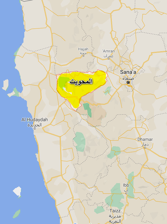 Sana'a Governorate from the east and south, Hajjah governorate to the north, and Al-Hudaydah governorate to the west.
What is the size of Al Mahwit Governorate?
The governorate’s size is about (2328) square kilometers, distributed over nine districts.
What is the population of Al Mahwit Governorate?
The population of Al Mahwit was 495,865 according to the 2004 census, and the number is increasing annually at a rate of (2.88%).
What are the districts of Al Mahwit governorate?
The governorate is divided into (9) districts according to the last administrative division as follows:
- Al Khabt District
- Al Mahwit District
- Al Mahwit City District
- Ar Rujum District
- At Tawilah District
- Bani Sa'd District
- Hufash District
- Milhan District
- Shibam Kawkaban District
What are the major tourist and historical attractions in Al Mahwit governorate?
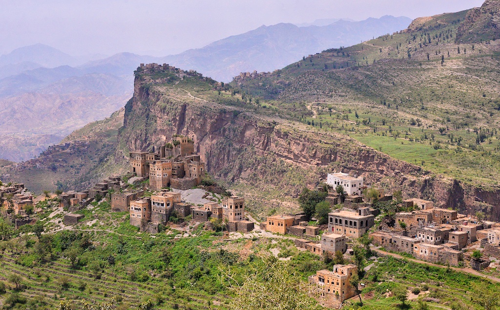
Al Mahwit is considered one of the most beautiful governorates in Yemen, with its picturesque nature. There are numerous archaeological and historical sites scattered in most of the governorate’s districts, the most prominent of which are:
Al-Samsara, Radman Fort, Jabal al-Tibs, Al-Riyadi, Shibam Kawkaban, the Great Mosque, Kawkaban Fort, Prince Shams al-Din's Mausoleum, Al-Ahjar town, Qarani Fort, Qaidan Mosque, Al-Qalaa Mosque, Asshamikh (the Impressive) Fort, Shamsan Fort, Hajar Al-Sayed Fort, Barash Fort, Al-Jahili Fort, Al-Rujum District, Al-Rujum Fort, Al-Sanafah Hijra Mosque.
What is the climate of Al Mahwit Governorate?
Al Mahwit combines mountain and plain climatic factors. In the mountainous regions, the temperate climate prevails in summer with cold winter, while the plain areas adjacent to the Tihama region are dominated by hot summer and mild winter.
Sources:
- Central Statistical Organization, 2006
- Wikipedia - National Information Center (Arabic)
- HUMAN ACCESS (Media Center)
- Yemen figures and facts (the National Information Center).
- Results of the tourism survey during the period from (1996-1999)
