- +40-700-123-4567
- email@example.com
- 14th Street, New York


Where is Mahra Governorate located?
Al-Mahra is the easternmost governorate of the Republic of Yemen and the second largest in the country after Hadramaut, and it forms the eastern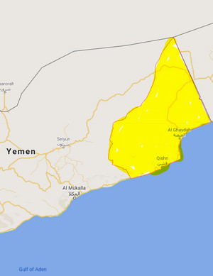 border with the Sultanate of Oman. The governorate is connected to the desert of the Empty Quarter from the north, Hadramaut governorate from the west, the Arabian Sea from the south, and the Sultanate of Oman from the east, and it is called the eastern gate of Yemen. It is about 1318 kilometers away from the capital, Sana'a. Al-Ghaydah city is the center of the governorate.
How large is Al-Mahra governorate?
The area of the governorate is about (67,297) square kilometers, distributed over nine districts. The district of Hat is the largest in the governorate (19,303) square kilometers, while Hawf district is the smallest in terms of area (1531) square kilometers.
What is the population of Al Mahra Governorate?
The population of Al-Mahra governorate constitutes (0.5%) of the total population of the Republic, and is therefore considered the least densely populated. Its population is (88,594) people, according to the results of the 2004 general census. Its annual population growth rate is estimated at (4.51%).
What are the districts of Al-Mahra governorate?
Al-Mahra is divided into (9) districts according to the last administrative division as follows:
- Al Ghaydah District
- Al Masilah District
- Hat District
- Hawf District
- Huswain District
- Man'ar District
- Qishn District
- Sayhut District
- Shahan District
- Rimah District
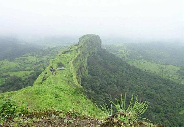
What are the key tourist and historical attractions in Al-Mahra governorate?
Al-Mahrah offers a lot of unique opportunities for adventure travel and cultural exchange. It has various tourist and historical sites, the most prominent ones are: the historical city of Al-Ghaydah, Al-Ghaydah Museum, the village of Muhaifif, the village of Dhaboot, Khalfut port, the port of Nashtoon, the settlement of Habrout, the beach of Balhaf, Amrit Fort, the port of Khor Al-Ozon, Haytoum the mountains, and the mountains of Mararah.
What is the climate of Al-Mahra Governorate?
Al-Mahra governorate is dominated by a dry tropical climate with the exception of the Hawf region, which receives regular annual rainfall. The maximum temperature in the governorate is 33 °C and the lowest is 18 °C in the coastal areas bordering the shores of the Arabian Sea.
Sources:
- Central Statistical Organization, 2006
- Wikipedia - National Information Center (Arabic)
- HUMAN ACCESS (Media Center)
- Yemen figures and facts (the National Information Center).
- Results of the tourism survey during the period from (1996-1999)
